PLING
Platform-based Integration and Use of Extraction Data
Motivation
Secure and sustainable raw material supply is a key prerequisite for industry and the energy transition, but is increasingly challenged by geopolitical uncertainties, rising demand for high‑tech commodities and complex, heterogeneous ore bodies. Conventional exploration based on drilling and static resource models has limited resolution and local accuracy for tactical and operational decision‑making in mines. At the same time, there is a growing need to significantly reduce energy and water consumption, emissions and environmental impacts of mining and to increase societal acceptance.
PLING addresses these challenges by transforming sensor data collected directly during extraction – at the face, in muck piles, along the material stream and in residues – into “resource intelligence” for high‑resolution orebody characterisation and adaptive process control. The overarching aim is an integrated system that enables more complete resource utilisation, more selective mining, reduced material handling and a lower environmental footprint.
Approach
Within the PLING joint project, TUBAF, RWTH Aachen (AMT and MRE), Knauf Gips KG, Innomotics and the associated partners Zinnwald Lithium GmbH and K+S are developing a flexible hardware and software platform that links mobile sensing, data platform, resource modelling and decision support in real time. A robust underground sensor carrier platform integrates multiple sensor types (including VIS‑SWIR and hyperspectral cameras, LIDAR, radar, XRF, RGB) and is coupled to a cloud‑based data and modelling environment. Building on this, algorithms for real‑time updating of local resource models and for tactical and operational process optimisation are developed and demonstrated up to TRL 6 in three representative use cases (lithium, potash, gypsum/anhydrite).
Within PLING, MRE is responsible for developing a system for contactless identification and characterisation of ore and waste‑rock minerals, based on hyper‑ and multispectral data, and leads the environmental monitoring work package in which this mineralogical information is linked to an integrated monitoring system. The aim is a system that captures and analyses mineralogy, contaminant levels, geotechnical parameters and meteorological conditions in the direct influence zone of mining operations in order to detect potential environmental interactions at an early stage. This includes the development of a database to track the mineralogical composition of waste rock and tailings, as well as algorithms for early detection of environmental risks such as acid mine drainage or ecotoxicologically relevant element concentrations. All environmental and geological data are linked to the mapping of ore and gangue minerals and integrated into the central resource model to support environmentally responsible mining, valorisation of mine wastes and sustainable post‑mining land‑use strategies.
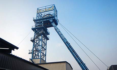
The PLING technology is demonstrated in three case studies: in the Hüttenheim anhydrite mine (Knauf) for boundary detection, resource modelling and drill rig automation, in the Werra potash mine (K+S) for value optimisation, and in the Altenberg/Zinnwald exploration gallery (Zinnwald Lithium) for sensor‑based exploration of a lithium deposit. Results will feed into international standards, in particular the United Nations Framework Classification (UNFC), and will be transferred to academia and industry through publications, an open‑access online course and integration into MSc programmes.
Project objectives and questions
Overall objective
To develop, integrate and demonstrate a sensor‑based platform that links extraction data, resource models, environmental information and production control in real time, thereby enabling more sustainable, resource‑efficient and environmentally compatible mining and proving its performance up to TRL 6 in three industrial use cases.
Specific objectives
- Develop and commission a robust mobile sensor platform with application‑oriented sensor concept for orebody characterisation, environmental monitoring, localisation and adaptive process control under underground conditions.
- Design and implement a scalable data platform including data management and data‑use concepts that integrates sensor data, resource models and operational planning systems in a “single‑point‑of‑truth” architecture.
- Develop a software module for real‑time updating of resource models, including uncertainty analysis and approaches for exploration optimisation in highly uncertain model regions.
- Design and implement an integrated environmental monitoring system for contactless characterisation of ore and waste minerals, assessment of environmental indicators and derivation of strategies for selective waste treatment and post‑mining land use.
- Develop data‑driven approaches for dynamic production control, including sensor‑based boundary detection, quality classification and automated drill rig positioning.
- Demonstrate and validate the overall system in real mine environments, derive best‑practice guidelines, contribute to standardisation (e.g. UNFC) and elaborate a comprehensive exploitation and knowledge‑transfer plan.
Work packages
- WP 1: Requirements and use‑case analysis
- WP 2: Carrier platform and sensor concept
- WP 3: Data platform and integration
- WP 4: Resource model
- WP 5: Environmental monitoring
- WP 6: Acquisition and use of sensor data for optimised resource extraction
- WP 7: Demonstration of the overall system
- WP 8: Exploitation
- WP 9: Project management and outreach